

Olalla Cemetery, Kitsap County, Washington
The Olalla Cemetery, located on the Gig Harbor Peninsula just over the Pierce County Line in Kitsap County, sits high on a hill overlooking a small inlet in Puget Sound. It was established, according to early records, at a meeting of the electors of School District 17 on 2 Feb 1901, and consists of one and one-half acres. The cemetery was abandoned in 1930 and there have been no burials in it since that date. It is a pioneer cemetery, overgrown and seemingly forgotten, with many stones tipped and broken or completely lost. Amongst the tilting headstones are pipe markers topped with red paint.
It is said this is the cemetery where the victims of Starvation Heights are laid to rest. It is also said that the markers represent where headstones of the victims used to be, but popularity and/or vandalism compelled them to replace the stones with the poles. I have seen nothing to confirm that story, however. There are a lot of these markers and are very difficult to count because the cemetery is laid out in such a rambling manner. Overgrowth was also a factor and I stopped counting when I got to 40.
The old Olalla cemetery has a fascinating past. I read the book Starvation Heights when I first moved to the area and have wanted to go explore this particular area since.
Story of Starvation Heights and Linda Hazzard
Because of the tragic nature of the story, many people believe this cemetery is haunted and it is listed on several paranormal sites.
I found it nothing but peaceful. It is not far from the road (150 yards or so) so you can hear the occasional car going by but the setting of the cemetery itself is quite tranquil. I saw a previous youtube video from 2011 that was slightly different from my photos and video. We had a recent windstorm earlier this year 2014 and it completely uprooted one of the larger trees which in turn lifted a burial sites/marker and narrowly missed a few others.
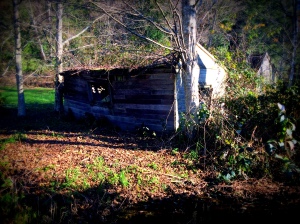
The site of Dr. Hazzard’s home is not far from the cemetery. The hospital and surrounding buildings have been torn down, unfortunately. I find it almost criminal when such fascinating pieces of history are deliberately destroyed. There are people who live in the home but they do not want to be bothered and it took me about 15 minutes (and I have years of online investigative experience) before I found the address.
The cemetery is public. But boy howdy, they don’t make it easy to find. Several websites have misleading directions. In the interests of accuracy I will be providing accurate directions along with pictures of the entrance. If you are the type of person who is going to be vandalizing a cemetery, this is one of these few occasions that I hope the cemetery is indeed haunted and the ghosties will take a bite out of your disrespectful derriere if you try to disturb the peace. Honor the past, folks. It is the right thing to do.
Here is a map. The trail is right off Olalla Valley Road. If you are meandering around Orchard Avenue you are in the wrong place. Also, if you hit Al’s Market and the bridge that goes over the inlet you have gone too far.
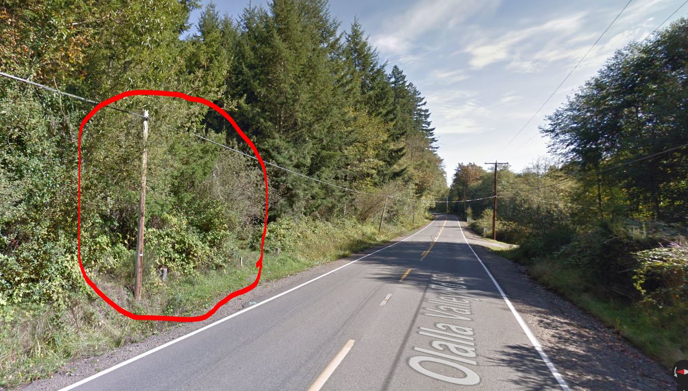


You will hike up 150-200 feet in an upward SE direction before arriving at the cemetery.


Headstones


Peaceful Ambient Scenes from the Cemetery


Fascinating story!
LikeLike
You can get the book Starvation Heights from Kindle for only $1.99 through December 26!
LikeLike
What did it appear the red stakes were for? I’ve heard that some such marking might be used if graves were unmarked or tombstones went missing hut these seem more permanent in the photos. Interesting post.
LikeLike
I heard the same thing, L. I couldn’t tell for sure but the number of stakes all over the place confirms the theory they are unmarked spots for the missing. The stakes were certainly not for directions or a specific area because they were far too spread out.
LikeLike
Thanks for such specific directions. I am doing research on Kitsap County abandoned cemeteries and had tried to find this one previously. We were there today. The trail was icy but in good shape and it looks like someone has been clearing overgrowth and keeping the ivy under control.
LikeLike
You’re certainly welcome. Did you make it up to the gravesites, Ann?
LikeLike
Hello. I was wondering where you parked? Just on the side of the road? And if so, was your car safe?
LikeLike
Yes, I parked nearly right across the road from the entrance. There was enough room for me to park safely. There is a dirt road that goes the opposite direction as the cemetery on the other side of the road, and I think you could probably safely park on it as well.
LikeLike
Thank you for this article and the detailed directions to the old Ollala Cemetery. With this guidance my cousin and I were able to locate the grave of my great-grandfather, Leander Anderson, a couple of summers ago. He and his infant daughter, Ines, Past during the “Spanish flu” in the winter of 1918. Family new of the cemetery but not exactly where it was located. With your help we were able to pay a long overdue visit.
Thank you ,
Ron Songer
LikeLike
I’m glad I was able to help!
LikeLike